Costa News Spain Breaking News | English News in Spain.

Andalucía weather: from 30C to possible storms next week
Almudena Nogués
Thursday, April 2, 2026, 14 :19
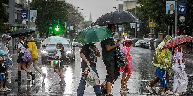
State meteorological agency Aemet predicts the return of storms and locally heavy rainfall to Andalucía next week, after a long weekend of high temperatures and clear skies.
The pleasant weather will dominate the final stretch of Holy Week in Andalucía. Stable conditions, little rain and significantly rising temperatures will mark the peak days, from Maundy Thursday to Easter Monday, according to Aemet spokesperson Rubén del Campo.
On Sunday and Monday, temperatures will reach up to 30C at some locations in the Guadiana Valley and Guadalquivir valley.
This will not continue for the whole week. Experts say that a low-pressure area could bring storms on Tuesday, as spring continues to go through its usual ups and downs.
Until then, however, a low-pressure system will form in central North America and move towards the Atlantic, possibly reaching Spain. The weather will remain dry and clear through the weekend, and into Monday when a low pressure system that forms in central North America moves towards the Atlantic.
Meteored, a weather portal, warns that a cyclogenesis could occur over the weekend “although the forecast is uncertain”.
Meteored states that the storm will arrive in the country via a cold front accompanied by maritime air polar and an upper-level low. The temperatures would drop significantly starting on Monday. Rain and storms will also arrive in large parts of Spain and Portugal over the next week.
“We may be witnessing the first significant storm event this spring.” Samuel Biener, a researcher and expert in climatology, says that a front will sweep the country from west to eastern between Tuesday and Thursday.
“We’ll have to confirm it, but we can expect locally heavy rain, most likely in Andalucía, Extremadura, Castilla-La Mancha, the region of Madrid and mountainous areas of the eastern half of the country. Due to the possibility of a secondary system of low pressure, storms may intensify on Wednesday along the Mediterranean coastline and the Balearic Islands. In the next few days, we’ll confirm the severity of this weather event, but for now, keep your umbrellas handy,” Biener advises.
Meteored has been told that, following the deepening trough in the atmosphere, this wave may break away from general circulation by the end next week and form a cold drop or ‘dana’ north of Morocco.
Currently, Aemet estimates a 30 to 90 per cent chance of showers on Tuesday in Andalucía, especially from 12pm onwards in interior areas of the provinces of Huelva, Seville, Cordoba, Granada and Malaga and less likely in Cadiz and Almeria. The temperature will also be milder with maximum temperatures dropping more than 5C and settling at around 25-26C.