Costa News Spain Breaking News | English News in Spain.


Monday, 17th March 2025 at 09:42
Konrad was named after the storm that struck Spain last weekend. The rain continued in many places, just as it had done for most of March. Heavy snowfalls have left the area In mountainous regions, temperatures will drop sharply.
A new week is approaching. We are now in the second half monthAlthough some people might think that the weather will stabilize, this is far from the truth.
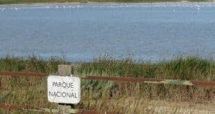
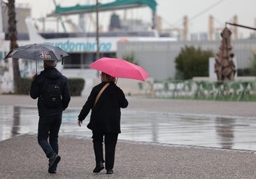
According to the Spanish weather agency (Aemet), a new storm is brewing over Spain. It’s called Laurence. It will be here on Monday, 17 March. precipitation «locally heavy and persistent in the southwest Spanish mainland, occasionally accompanied by thunderstorms without ruling out the occasional presence of tornadoes on the Atlantic coast« is expected. The rains may spread to the Balearic Islands and other parts of Spain, but are unlikely to reach the Cantabrian sea and extreme north-east.
Snowfall is also expected in the mountains of northern and central Spain, but it will decrease as the day goes on. Aemet is experiencing both types of precipitation. activated amber and yellow ‘risk’ warnings in Andalucía, Aragon, Castile y Leon, Castile-La Mancha, Catalonia, Extremadura and the Madrid region.
Above-average rainfall
According to Meteored, the forecasts indicate that «the rains will be abundant in the southern half of the peninsula. Most areas in the south are expecting between 5 and 10mm of rain. Madrid , including the Madrid region itself«. In addition, in Andalucía more than 50mm It is possible that Extremadura or the extreme west of Castilla La Mancha will receive a similar amount of rainfall.
«The national rainfall ranking will once again be crowned by Andalusian weather stations: more than 50mm are expected in 24 hours in the provinces of Cadiz and Seville,» Meteored said.
Tuesday 18 March will also be a rainy day. More than 10mm of rain fell in all regions, except for Galicia and Asturias. The worst affected areas could be the provinces of Valencia and Castellón, part of the Central System and the Strait of Gibraltar and the coasts of Malaga and Granada provinces.
The third day of this week will see a temporary truce in the rain, but the break will only last a few hours. Aemet sforceass that this Wednesday «will be A day between two storms in Spain, where the last remains of storm Laurence will affect the northeast of the peninsula, while a new frontal system starts to penetrate from the west«.
This new storm, Laurence’s successor, will arrive in the late afternoon. You can enter PortugalCrossing the border will start to affect areas in Spain that are nearby.
⛈️Llega la borrasca Laurence con lluvias abundantes a amplias zonas de nuestro país. También impulsará aire más templado, por lo que las temperaturas y la cota de nieve subirán.
→ El miércoles será un día de transición entre dos borrascas: el jueves llega otra con más lluvia. pic.twitter.com/ouT9Az8ELB
— AEMET (@AEMET_Esp) March 16, 2025
Raise the temperature
New days, in contrast to a cold weekend which saw snow and frost return to some areas of Spain, pose a challenge. a different scenario.
Aemet’s forecast indicates that the weather will be warmer from Tuesday. minimum temperatures will rise noticeably, especially in the east of Castilla y León, the Cantabrian mountains and the north of the Iberian System. On Wednesday 19, maximum temperatures Temperatures will rise in all of the peninsula and in the north. The Pyrenees is the only place where you will see any frost.