Costa News Spain Breaking News | English News in Spain.

The polar Vortex, which is a ring-shaped area of low pressure and frigid air that typically resides over the Arctic region in winter, shows signs of serious deterioration. It could soon collapse or split, causing freezing conditions to spread southward. This atmospheric disruption could be caused by a sudden stratospheric heating event that occurs in early February of 2026. It raises concern about cold waves reaching the southern latitudes including Spain.
Polar vortex breaking apart – could move south
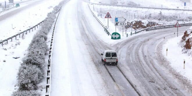
Andrej Flis, a meteorologist from severe-weather.eu explains This suggests that the polar whirlwind has been weakening for several weeks. This instability has allowed areas of cold air to move southward and contributed to recent severe cold snaps across North America, Northern Europe, Russia, and Scandinavia. A southward-shifted jet stream combined with blocking anticyclones over Greenland, Scandinavia and Greenland has funneled a train of Atlantic Low-Pressure Systems into Spain. This brought persistent rain, strong wind and even snowfall to many parts of the Iberian Peninsula.
A potential sudden stratospheric warming The vortex could be further destabilised, splitting and sometimes influencing the troposphere – where the surface weather develops. It appears that this could strengthen atmospheric blocks, causing cold outbreaks to move from east toward west. However, Flis warns As not all stratospheric phenomena propagate downwards, their effects can be felt in any region of the Northern Hemisphere, so specific effects on Spain are uncertain at this time.
According to AEMET – Spain due a cold snap – But where?
This is the first official coldwave in Spain for nearly three years. The State Meteorological Agency defines one as at least three consecutive days Where at least 10% or more of stations record temperatures below the January-February average.
In the short term, the Greenland-Scandinavia block will keep Atlantic storms tracking southward, delivering widespread and heavy rains across Portugal, Spain and the Balearics, especially in Galicia and Grazalema, Malaga Province.
In February, Spain is greeted with rain and cold.
A new Atlantic low arrives for the beginning of February, bringing generalised rain, the heaviest in Galicia, western Castilla y León, Extremadura, western Andalucia, and the Central System, extending eastward Monday before weakening. Snow is expected to settle at lower levels, possibly down to 500 metres.
Experts monitor the polar Vortex for signs of a shift towards harsher temperatures in the coming weeks.