Costa News Spain Breaking News | English News in Spain.


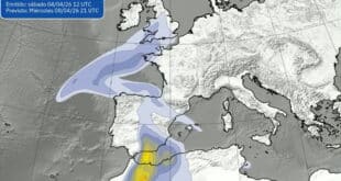
A cold front that is unusual in nature will bring snow to many places. Photo Credit: Pablo Peu/Shutterstock
Spain is preparing to experience a sudden change in weather. A polar air mass will move across the country, bringing with it a drop in temperature and a reduction of snowfall. Spain’s national weather agencyAEMET( warns that in the coming days snow may fall at unusually low elevations. This could have a significant impact on travel and transport as well as daily routines.
Forecasters expect that the cold air, also known as “cota d’nieve” locally, will cause the snow-level to drop by around 500 metres, in certain northern and northwestern areas. This could lead to snow falling in valleys or elevated plains below the usual mountain zone. Temperatures are expected to be below normal, especially during the day. This could lead to ice on roads and other exposed surfaces.
Where and why snow could fall
Snow levels are low in the mountains and beyond
This unusual cold front will bring snow to many areas, and not just the traditional winter hotspots. Snow may fall at lower altitudes than normal in northern Spain. This includes Galicia and Asturias. In the central plateau and interior regions, such as Castilla y León, Navarra, and La Rioja, flurries and icy conditions could appear across rural landscapes and high plains.
Madrid may also see snow, and elevated areas of the city as well as surrounding areas are at risk when snow levels drop. Snowfall in the Pyrenees is expected at varying altitudes. In some valleys, there may be snow at lower levels. Meanwhile, Catalonia, Aragón, and Castilla La Mancha may experience snow on higher ground and moderate elevations as cold air interacts with moist weather fronts from the Atlantic.
In the Mediterranean and southern regions, snow levels should remain at around 1,300-1,500 metres. However, mountain slopes might still see significant snow accumulation. The combination of falling temperatures and low snow levels will create conditions that are rarely seen this time of the year.
Provinces and areas most at risk
Spain may experience snow and ice across large parts of the country
In the next few days, snowfall and icy surfaces are expected to affect several provinces:
- Snow could fall in the northern part of Spain, including Galicia, Asturias Cantabria and Basque Country.
- Interior plateau: Castilla y León, Navarra, and La Rioja may experience snow flurries and icy conditions across rural and elevated areas.
- Madrid and its surroundings: There is a chance of snow in the hills surrounding the capital.
- Pyrenees & Catalonia: Expect snow across mountain ranges & some lower valleys
- Aragón and Castilla‑La Mancha: Higher elevations and moderate altitudes may see snow accumulation.
Although the snowline is low for this season, some lower areas of the country could still see snowflakes.
Travel Safety and What to Expect Next
Conditions change and require precautions.
Authorities urge residents and travellers alike to exercise caution as the polar mass passes through. In mountainous and rural areas, road conditions can deteriorate. The forecast is a good reminder to drivers to prepare their vehicles for winter, and include appropriate chains and tyres if necessary.
Meteorologists stress that the situation is fluid. While forecasts indicate a cold snap that will bring widespread snowfall, the exact location of snowfall and its intensity may change depending on how the air mass interacts with the regional weather patterns. Residents should be aware of the changing weather conditions and adhere to safety instructions. This weekend marks the start of winter, with low temperatures and falling snow levels. There is also the possibility of snow in areas outside the typical mountain zone. This event is a reminder of the early arrival of winter in Spain. Conditions are likely to last for several days, before easing.