Costa News Spain Breaking News | English News in Spain.

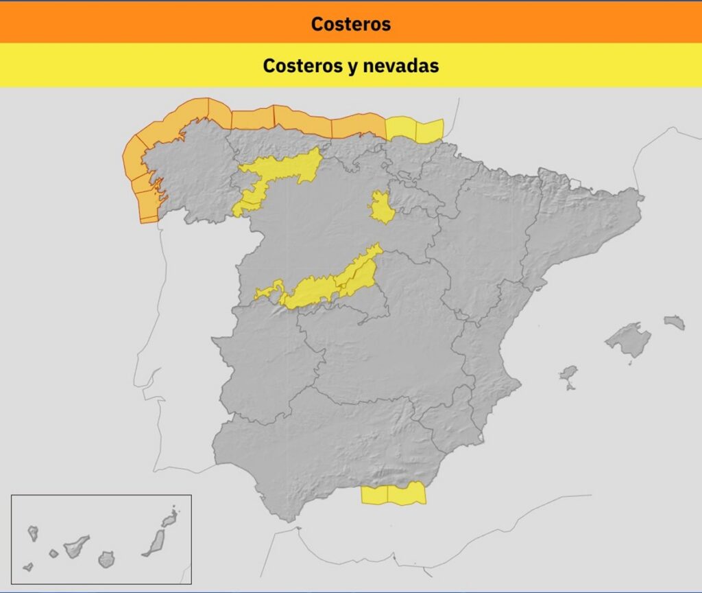
AEMET map highlighting storm warnings along the Galician and northern coasts.
Credit : X – AEMET
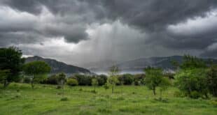
Galicia is waking up to one of the toughest weather days of the week as powerful Atlantic seas batter the coast, with A Coruña right in the firing line. Spain’s weather agency AEMET has activated an orange warning for coastal wave conditions, forecasting waves of up to six metres along the exposed Coruñan shoreline.
The rough seas are part of a wider storm system affecting much of northern Spain. While alerts also stretch across parts of Lugo, Pontevedra, Cantabria and Asturias, forecasters say conditions around A Coruña could be the most severe, with waves potentially smashing into promenades, harbour areas and other exposed sea fronts.
Strong winds drive the swell along the galician coast
The dangerous sea state is being fuelled by strong winds from the west and south-west, sweeping across the Iberian Peninsula and the Balearic Islands. The gusts are expected to blow hardest over northern inland areas, the south-east, and – crucially – the coastlines.
Across Galicia and the Cantabrian coast, these winds are whipping up heavy swells, pushing wave heights towards the upper end of forecasts and keeping the orange maritime alert firmly in place for A Coruña. Similar windy conditions are also affecting parts of the Alboran Sea, adding to the unsettled nationwide picture.
With rising tides and constant gusts, there’s a real concern about sudden wave surges hitting walkways, beaches and harbour walls without warning.
Authorities urge public to stay clear of the sea
Local emergency services and council officials are stressing the need for common sense and caution. People are being told to avoid promenades, breakwaters, cliffs and other areas close to the water where rogue waves could pose a serious danger.
Drivers are warned not to leave vehicles parked near the shoreline or in low-lying coastal zones where spray or flooding could occur. Residents are also advised to secure any outdoor furniture or loose objects that strong winds could dislodge and send tumbling.
AEMET and Civil Protection teams are closely monitoring conditions throughout the day and advise the public to check official updates regularly as the storm system continues to develop.
Rain, fog and falling temperatures across the country
Beyond the dramatic scenes along the Galician coast, the storm’s reach is being felt across large parts of Spain. An Atlantic front is covering most regions with cloudy skies and bands of light rain, moving steadily from west to east.
Rain is less likely to reach the eastern third of the peninsula and the Balearic Islands, but Galicia is set for further downpours later in the day as a new frontal band rolls in from the Atlantic. Western areas of the region could see heavier or more persistent rainfall.
Morning fog has also appeared in several inland areas, including the northern plateau, parts of the southern plateau and Galicia itself, with some patches expected to linger well into the day.
Temperatures remain uneven. Daytime highs are creeping up slightly in places such as the Valencian Community, Melilla, the upper Ebro valley, northern plateau areas and the Balearics, while much of the rest of Spain is seeing cooler daytime temperatures. Overnight lows are ticking upwards in most regions, except in parts of Andalusia, eastern Spain and the islands.
Light frost is expected in mountain areas of northern and south-eastern Spain and across the northern plateau, with the Pyrenees facing the risk of moderate frost.
Snow alerts for central and northern regions
Alongside the coastal storm, snow warnings are also in force for inland provinces including Madrid, Ávila, Segovia and Burgos. Weather services are forecasting up to five centimetres of snowfall within 24 hours, particularly across the Sierra de Madrid, the Central System mountain range and areas of the Iberian range in Burgos.
Snow levels are expected to settle between 1,000 and 1,200 metres in the north, rising to around 1,500–1,700 metres in south-eastern mountain zones.
Unsettled Skies Over the Canary Islands
Further south, the Canary Islands are also experiencing a mixed weather picture. The north of the mountainous islands is staying cloudy with occasional light showers, while the rest of the archipelago sees alternating cloud and clear spells. The familiar trade winds remain active, blowing strongly in exposed coastal areas.