Costa News Spain Breaking News | English News in Spain.

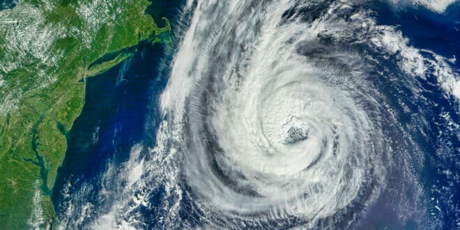
NASA satellite image of hurricane Erin over Atlantic. Iberia should only experience its remnant moisture, cooler air and less heat.
Credit : BEST-BACKGROUNDS, Shutterstock
The weather in Spain is about to change. The weather in Spain is about to change.
What Erin means to Spain’s skies
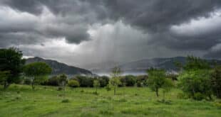
It’s not a hurricane, but there is still enough energy to cause a shift in our weather patterns. Over the next few days, fronts linked to the trough will push into the peninsula from the west, crossing the northern part of it. They’ll drag low clouds and fog at dawn and then sweep sheets of mid- and high-cloud west-to east. As the air becomes unstable, showers will pop up and turn into thunderstorms. Some of these may be strong, with frequent lightning.
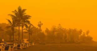
AEMET also flags two extras that matter on the ground: a shift to a westerly wind as the fronts clear—a moderate poniente in the Alborán—and occasional calima (Saharan dust) around Alborán, the far east and the Balearics, which can haze the sky and leave a gritty film on cars.
Who gets soaked – and who stays summery
If you live north of the Cordillera Cantábrica, along the Ebro or up into the Pyrenees, keep the brolly by the door. This is where the rain will be the most persistent, with storms likely to occur over the eastern Pyrenees.
The Mediterranean side of the island and the Balearics are a mix: there’s plenty of sun between sharp, short downpours which can quickly turn heavy.
Further south, fronts arrive tired—more cloud than clout—so many communities keep a late-summer feel.
Not everywhere, temperatures are changing. Most of the daytime temperatures will be lower, whereas the south-east and Balearics coasts could see a slight increase. Even so, isolated spots could still touch **35°C in the southern interior, north-east basins and the islands. Nights stay muggy near the Med, with minimums around or above 20°C from the Guadalquivir to the mid-Ebro and across the Balearics.
The Canaries are mostly sunny: more so in the south and cloudier up north, with a few light showers. A strong trade wind is blowing.
Travel sense: small tweaks, big difference
This setup is classic late-August mischief—not a washout, but enough to catch you out. When hiking in the mountains or driving over mountain passes, it’s best to get started early. Watch streams after lunch as storms are more likely to bubble. When on the beach in the Balearics and along the east coast, you should be on your guard for any thunder. Drivers: the first rain following a dry period can make roads slippery. Pre-dawn fog in northern valleys is also possible.
Erin’s leftovers give Spain a short-lived, almost autumnal, jangly feel before we return to something more seasonable. Keep suncream and umbrella in the same bag—you’ll probably need both.