Costa News Spain Breaking News | English News in Spain.


La Niña could return from September, UN forecasters warn.
Credit : FrankHH, Shutterstock
The short version is: UN’s weather agency says La Niña has a better-than-even chance of switching on from September, yet a cooler Pacific won’t suddenly switch off Europe’s warmth. The autumn in Spain will still be warmer than normal, with bursts from the Atlantic.
La Niña forecast: What the WMO is flagging
The World Meteorological Organization (WMO) reckons there’s about a 55 per cent chance La Niña develops between September and November, nudging to around 60 per cent for October–December. We’ve been neutral since March 2025, with no El Niño since 2024.
La Niña is simply the Pacific running cooler than normal in its central and eastern stretches. This slight change in ocean temperatures affects tropical clouds and winds, which then alters weather patterns around the world. It’s not just a switch, it’s an adjustment of the odds.
WMO emphasizes that the human-induced warming is still present. Even with La Niña in the mix, seasonal temperatures can still sit above the long-term average in many regions.
Spain & Europe: What the autumn actually feels like
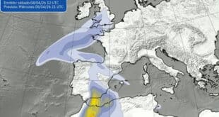
For Spain and much of Europe, the broad signal into autumn is ‘warmer than it used to be’ – not wall-to-wall heat, but above the seasonal norm. The warmth will be punctuated more by active Atlantic spells. Expect blustery fronts with short, intense rains, occasional hailstorms, and gusty coastal weather, especially if storms are able to tap into summer moisture.
It’s a classic September–November pattern: pleasant, sometimes summery afternoons, followed by snappier changes when a front barrels in. Inland, localised flooding can be caused by the first proper rainfall after a long hot spell. On unsettled weather days, coastal winds are strong and the sea is choppy.
La Niña can shift where the rain and wind show up and when they bite – but it won’t magically deliver a long, cool autumn.
Takeaways to remember for the coming weeks
Keep your eyes on updated advisories, especially those regarding coastal wind and thunderstorms. Keep an eye on updated advisories – particularly thunderstorm and coastal wind warnings – and remember that the first heavy showers after dry heat are the ones that overwhelm drains. Don’t park on known dips when there are storms in the forecast. Also, plan your outdoor activities with a backup plan.
It’s a heads-up for travellers and not a flag. Airports can be slowed down by squally winds, and city breaks are often under a warm, muggy atmosphere before the front passes. Keep the sunscreen and brolly in your side pocket. Pack lightweight layers.
La Niña looks increasingly likely from September, tilting the dice towards livelier Atlantic weather – yet in today’s climate, that nudge won’t cancel the warmth. Expect an autumn that is warmer than average in Spain, and throughout much of Europe.