Costa News Spain Breaking News | English News in Spain.

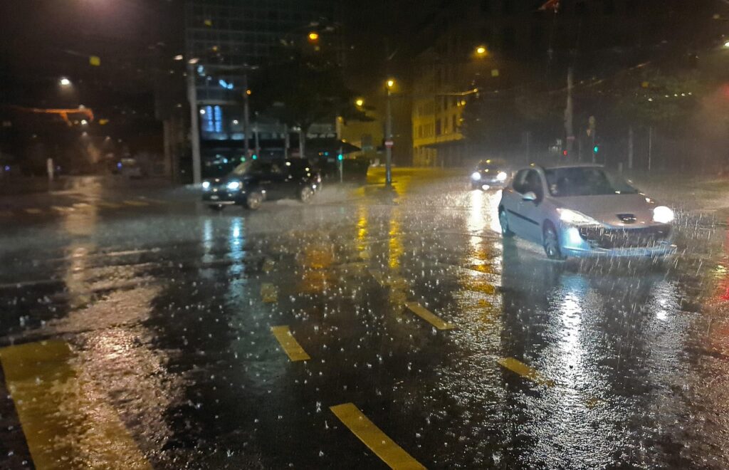
Tarragona is expecting around 90mm of rain per hour. Photo credit:Andreas/Pixabay
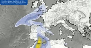
The Spanish State Meteorological Agency (AEMET) has issued a red warning for the southern coastal and pre-coastal areas of Tarragona, as torrential rainfall is expected to affect the region later today. The warning, indicating an extreme risk, is in effect from Monday September 8 until Tuesday September 9 until around 9:00pm Authorities are urging residents to take precautionary measures to minimise the risk of flooding and related hazards.
During the warning period, rainfall accumulations of up to 90 millimetres per hour are forecast, with intense thunderstorms accompanied by gusty winds and the possibility of hail. Such conditions could result in rapid river rises and flash flooding, particularly in low-lying areas and near riverbanks. The Civil Protection Department of Cataluña has activated the INUNCAT flood emergency plan and issued alerts through the ES-Alert system to inform residents in the Baix Ebre and Montsià regions.
The adverse weather is caused by an Atlantic trough moving across the Iberian Peninsula, which, when combined with warmer-than-average Mediterranean Sea temperatures, is producing an unstable atmosphere conducive to heavy rainfall. Meteorologists warn that the same system is expected to affect parts of the Valencian Community and Aragón, where orange warnings have been issued. In these areas, rainfall totals of up to 60 millimetres per hour are anticipated, along with thunderstorms, hail, and strong wind gusts.
Local authorities have already taken precautionary measures. Several schools in Tarragona and the Valencian Community have been closed, and public transport operators are advising passengers to expect delays. Roads in vulnerable zones are at risk of flooding, and drivers are urged to avoid unnecessary travel. Ports along the Catalan coast are also on alert, and maritime authorities advise small vessels to remain docked until conditions improve. This red warning follows a pattern of increasingly severe weather events affecting eastern Spain in recent years, with previous episodes of torrential rain causing property damage, road closures, and localised flooding. Authorities stress the importance of adhering to official guidance and staying informed through AEMET updates and local emergency channels.
Residents are advised to avoid flood-prone areas, ensure that property drainage systems are clear, and keep emergency supplies accessible. For those in affected areas, moving vehicles to higher ground and avoiding walking through flooded streets are strongly recommended. The severe weather is expected to persist for the next 24 hours, with conditions gradually improving later in the week. AEMET continues to monitor the situation closely and will provide updated forecasts as the system progresses.
For the latest updates, residents are advised to consult official sources such as AEMET and the Cataluña Civil Protection Department.