Costa News Spain Breaking News | English News in Spain.

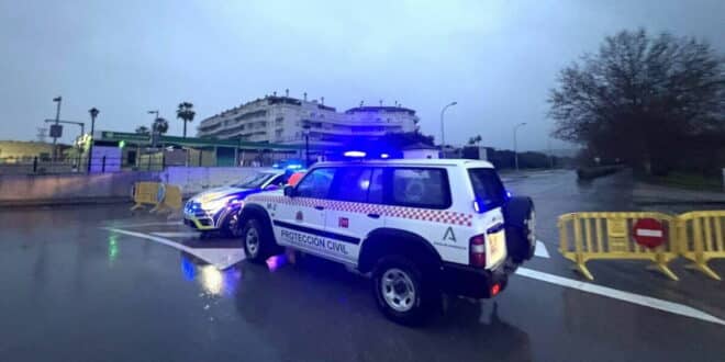
Cadiz Provincial Police and Civil Protection Block Roads
Credit PV Los Barros FB
Have you noticed there haven’t been any serious Caribbean hurricane alerts yet this year? All the bad weather in Europe is to blame. Visitors and residents from the UK or other northern European countries who are not used to Spain’s sudden changes in weather should avoid non-essential trips this week. Also, be aware of areas with rapid water runoff, like dry riverbeds and channels. Many parks, gardens Traffic on the mountain routes is prohibited until at least Friday.
Avoid coastal areas such as jetties, seawalls and certain promenades. The high winds can cause trees to fall, along with street fittings. Waves and overflowing drainage will also be a problem.
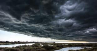
Spain will record the highest amount of precipitation in Europe. As successive Atlantic storms continue their heavy rain, they are pushing soils to the limit, causing flooding and river overflows.
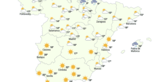
Rain threatens South and East Coasts
Residents of Andalucia and the Comunidad Valenciana should be prepared for continued unsettled weather conditions all week. The Iberian Peninsula continues to be flooded with rain, as a river of low atmospheric pressure channels intense weather systems towards the peninsula. Southern provinces, like Cadiz and Malaga can expect particularly heavy accumulations of rainfallThere are some mountainous and inland zones such as RondaIt is possible to see 100 to 200 mm of rain in a short time during the week. Orange and red alerts are issued in the provinces of Cadiz and Costa del Sol, where rain could reach 140 mm within 12 hours and 200 mm within 24 hours.
Eastern Mediterranean coastal areas, including Valencia MurciaThe forecast for daily rainstorms will bring wetter-than-usual weather. The accumulations in the South facing the Atlantic will be less than usual, but persistent showers over saturated ground can lead to localised flooding and surface water problems.
Flood risks increase when soils are saturated
The soils in much of eastern and southern Spain are near saturation due to weeks of rainfall above average. three times normal Cadiz, Granada and Jaen are some of the zones that have experienced this. The water infiltration rate has dropped dramatically, causing rapid runoff into urban drainage and rivers. This setup poses serious risks of rapid river surges even in the absence of extreme one-day floods.
Take warnings very seriously
Spanish weather warnings must be taken seriously, as recent tragedies in Andalucia and the Canaries have shown. Check weather warnings from AEMET If you are going to venture outside, please consult the official flood risk maps. Before crossing low-lying areas, such as ravines, ramblas and low-lying streets, check for floodable zones. Avoid parking your vehicle near areas that are prone for flash flooding.
Forecasts show that major rises in water levels and extreme flows are possible along certain sections of the southern rivers. Eastern systems, such as Jucar, Segura and Guadalhorce require close monitoring because upstream mountain contributions add to the downstream pressure. Urban areas are particularly vulnerable because of impermeable surfaces like roads and buildings. Even moderate rainfall can overwhelm aging drainage networks, causing giant puddles and street flooding.
Advice for residents of coastal communities
Keep an eye on low-lying rivers, streams, ravines and roads. Avoid crossing flooded areas by foot or vehicle as they can carry people and cars away unexpectedly. Monitor Official updates from AEMET, and local civil protection agencies for real-time notifications. Prepare by securing outdoor objects, moving vehicles higher if you can, and having essentials on hand in case of an evacuation.
Google’s new Flood Hub tool provides an interactive map that shows flood risk in real time, with short-term forecasts for flash flooding and riverine flooding. It can be accessed via mobile and desktop web browsers for location-specific insight, but it does not replace official flood maps. AEMET and emergency warnings.
Outlook still unsettled
The Atlantic systems are likely to persist into mid-February. It’s not all sunny in Spain. Strong winds and rough seas add coastal hazards along southern shores, while mountain snow in Sierra Nevada and Béticas could contribute to melt-related rises later. Residents along Spain’s southern and southeast coasts are advised to put safety first. They should limit travel and avoid non-essential activities during periods of heavy rain.