Costa News Spain Breaking News | English News in Spain.

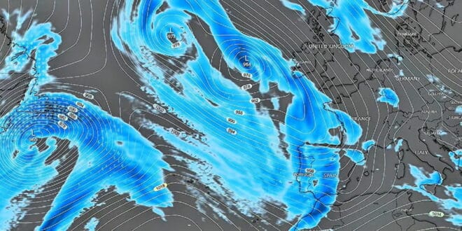
Spain’s February weather is still unreliable due to the Atlantic fronts.
Credit : Jorge Rey on YouTube
Many people in Spain have asked the same question after weeks of rain, strong winds, and flooding. Is this the final turning point?
According to Jorge Rey, not quite.
The young forecaster from Burgos, who has built a strong following thanks to his use of the traditional cabañuelas method, says the worst of the recent weather has eased just in time for Carnival, but warns that Semana Santa could still bring unpleasant surprises.
Spain’s rivers, in particular in the southwest and west, were already under stress after successive storms. Even now, even a new shower of rain is causing concern.
Against that backdrop, Rey has been looking ahead to the coming weeks – and his outlook has drawn plenty of attention.
Early February delivered what was expected – heavy rain before a brief lull
Rey predicted that the first two weeks of February would be a time of uncertainty. This forecast was almost exact.
The influence of El Niño, he explained, pushed Atlantic systems towards the peninsula earlier and more frequently than usual. Galicia and Extremadura received heavy rains, and west Andalusia also experienced heavy rainfall. Snow returned to the mountains and fell in lower than normal levels.
However, Rey had also pointed to a change around 6–7 February, when Atlantic fronts would weaken and higher pressure would build over the UK. This shift has occurred and the conditions have temporarily stabilised after weeks of disruption.
Carnival now looks calm – with only minor weather risks
Rey has a message that is mostly reassuring with the Carnival celebrations fast approaching.
He said this week that “Carnival would always arrive with relatively calm conditions.” “Nothing too dramatic.”
This does not mean that conditions are perfect everywhere. He still warned of cold air in the sky, which could bring overnight frosts to inland areas and isolated storms on the Mediterranean coast.
Still, compared with the storms and flooding seen in recent weeks, the outlook for Carnival events across Spain now appears manageable — a relief for towns that depend heavily on tourism during this period.
March remains unstable – and Easter is where concern returns
Beyond Carnival:
The month of March is likely to be unpredictable.
He expects temperatures to continue rising at the beginnings of March. At the same time, new Atlantic fronts could bring rain back to western Spain and the Canary Islands around 4–5 March.
That pattern – mild spells followed by cooler, wetter days – is likely to continue. A short-lived high-pressure system around 12–13 March could offer another pause, but Rey says it will be brief.
By mid-month, around 16–17 March, stormy conditions could return to the southwest, affecting Extremadura, Huelva, Seville and Cádiz.
However, his most striking warning concerns late March or early April. Rey believes that a change in pattern will bring colder air from the polar regions southwards. This could increase the chances of rain, lower temperatures, and even snow, especially in northern and central Spain, during Semana Santa.
“A bad Easter in the north and centre, with a strong chance of snowfall,” he warned – a statement that has drawn attention, especially given his accurate early warnings ahead of extreme events such as Storm Filomena.
The Spanish national weather agency. AEMETAs February advances, the weather will continue to be cold and wet, with more rain, snow and storms in the mountains.
Rey summarizes the situation with an old proverb:If Candlemas laughs the winter will last; if Candlemas cries it ends.
Carnival has a reprieve for now. Easter is shaping up as being far less predictable.