Costa News Spain Breaking News | English News in Spain.


Shutterstock | Credits: Shutterstock
The State Meteorological Agency, (Aemet), has issued additional weather warnings in Andalusia and the Balearic Islands. Also, Aragon and Castilla La Mancha are also included. Conditions will be unusual, as they combine the hottest days of June on record with hailstorms.
On Saturday, emergency personnel rescued 19 people after storms descended on Aragon with unusual force, under the orange warning, the second on a scale of three, El País reported. The storms affected the roads, railways bridges and transport infrastructure in Zaragoza as well as disrupting electricity and water supplies. No fatalities were reported.
Andalusia: 38 degrees Celsius
AEMET has issued a warning that temperatures could reach 34-36 degrees Celsius, (95-97 degree Fahrenheit), in parts of the southern peninsula, depressions located in the northeast of the country, and in the Balearic Islands.
However, in Andalusia, AEMET stated that heat could exceed 38 degrees (over 100°F) in parts of Andalusia, such as Seville and Córdoba, as well as in parts of Castilla-La Mancha and the Balearic Islands, including Menorca and Mallorca.
AEMET stated that specifically, it expected highs of 34°C (93.2°F) in Cuenca, 35°C (95°F) in Cáceres, Madrid, and Lleida, and up to 36°C (96.8°F) in provinces such as Jaén, Granada, and Murcia.
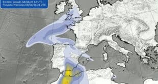
The weather agency also predicted that clouds would develop in areas in the middle and eastern thirds of the peninsula on Sunday afternoon. These storms could come in the form hail. The provinces of Córdoba, Jaén, Granada, Cuenca, Albacete, Teruel, Murcia, and Castellón have yellow warnings for this type of precipitation, news outlet 20 Minutos reported.
Showers are still possible in Andalusia despite the heat
Andalusia will also be cloudy, with light showers in the afternoon possible inland. In the mountains, showers will be more frequent and intense. Thunderstorms may also accompany hail.
Expect low clouds, mist and intermittent rain along the Mediterranean coastline. Clear or partly cloudy elsewhere. Dust in suspension, possibly with mud deposits. The temperatures will either remain the same or increase. Light, variable wind tending towards moderate easterly winds in the Strait of Gibraltar and along the eastern Mediterranean Coast during the afternoon.
According to the state climate agency, minimum temperatures will rise in the south-central third of the peninsula, while the north-central part of the peninsula and the inland areas of the northeast will see an increase. Other parts of the peninsula are expected to experience minimal changes. The minimum temperatures will be between 15 and 20 degrees.
Cantabrian region hit by heavy rain
In the Cantabrian region, heavy rain is possible in the early morning hours due to the arrival of this front.
AEMET has forecast cloudy skies and the possibility of light precipitation in the Canary Islands. However, the outlook for the day is to remain relatively clear. Temperatures across the archipelago remain stable, with lows of 20°C in Las Palmas de Gran Canaria and Santa Cruz de Tenerife. Highs in both cities will be 24°C and 26°C, respectively.
Forecast for Valencia and Murcia
Experts in the Valencian Community predict partly cloudy skies with high intervals of clouds and cloudiness throughout the day inland. Low probability of isolated showers with thunderstorms in the afternoon in the northern part.
Maximum temperatures are unchanged in all areas, but temperatures in Valencia and Alicante’s far north are slightly lower. Winds light and variable, turning easterly during the middle hours. Moderate on the northern coast.
Meteorologists in Murcia forecast high to medium clouds with occasional strong thunderstorms and hail. Temperatures are expected to remain unchanged.
The forecast for the Balearic Islands includes intervals between medium and high clouds. The temperature is either unchanged or the maximum temperature is falling. There are occasional light breezes from the east.