Costa News Spain Breaking News | English News in Spain.


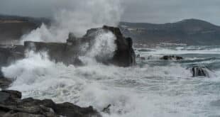
One of the worst storms of July to hit Alicante in recent years has left many parts of the province with flooded roads.
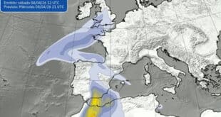
The State Meteorological Agency (Aemet) said the storm was linked to a trough crossing the area and stated that it was ‘more typical of late August or September than July’.
It’s far from the only time that storms occur in July. However, the fact they were so severe, persistent and widespread was a novel experience.
Thunder and lightning accompanied the night, particularly in southern Vega Baja.
The Valencian Meteorological Agency reported that Pilar de la Horadada received 76.7 litres per m2, 60 of which were deposited in just 20 seconds.
Around 1am, the downpour occurred.
Pilar council also said ‘severe damage’ had been caused to local beaches while ‘regular’ areas on the Orihuela Costa like the Playa Flamenca underpass were flooded.
Avamet reported 130.1 litres of water per m2 for Vall d’Ebo in the north.
Denia was affected by flooding, while Ondara’s bullring was also damaged.
Two boats were left stranded and drifting in Denia’s coves.
On Thursday night, around 9pm there was a power cut in Las Rotas. The supply was restored a few more hours later.
Alicante’s province was hit by strong winds that brought down trees, including one palm tree in Torrevieja on Paseo Vista Alegre.
In the area, there have been no reports of serious injuries or structural damage.
The weekend will be mostly sunny, with temperatures rising on Sunday. However, they won’t reach the highs of July.
Aemet predicts that the minimum coastal temperature overnight will be 18C, with the maximum in the day being just over 30C.
The Olive Press has more Costa Blanca News. Click here to read it.