Costa News Spain Breaking News | English News in Spain.


Spain has not had the typical early autumn breather. Meteored meteorologist Samuel Biener said a new heat dome will sit over the country from Wednesday to SaturdayAs autumn officially begins, thermometers will be sent back to the midsummer zone.
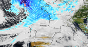
A strong ridge will heat the air while it sinks. Meanwhile, a pocket cooler air to the west of the peninsula will bring extra warmth from North Africa. Friday’s maps even put the 28ºC line at about 1,500 metres over the centre of Spain, a high thermometer reading for September.
Where 40ºC is back on the cards
In land, in places like Badajoz, Caceres, Ciudad Real, Cordoba, Granada, Jaen, Lleida, Sevilla, Toledo and Zaragoza, all are in the 40 to 43ºC bracket later in the week. Other towns in the inland will be not far behind.
Saharan Dust may obscure the sky in the south, south east and Balearics. It can take a couple of degrees off the afternoon high. After dark, this is hardly comforting. Tropical nights are expected over wide areas, and some spots in Andalucia, on the Mediterranean coast, in the Balearics and in the Canary Islands may stay above 25ºC.
Today, scattered showers will only be possible in the north-east and north. Clouds that build over the eastern Sierras, Pyrenees or Pyrenees on Tuesday and/or Wednesday could produce isolated storms.
Why even a “normal” trough is still dangerous
Seas can still be rough in late summer. Surface water hit a record 33ºC in places this season. Spain has already recorded record-warm coastal water this August, including 28.84ºC off Cabo de Gata in Almeria. Meteored’s Victor M. Gonzalez, and Samuel Biener, called that moisture “top-grade” fuel after a tornado tore across Pomas in France on 24 August.
French specialists at Keraunos set winds at 220-240 km/h on this six-kilometre track. Stone walls and roofs were punched out, while a 900-year old castle was half-ruined. Gonzalez’s warning to Spanish readers was blunt. The trough in itself was “very characteristic”. The extra energy required to sit over the scorching sea was not typical.
The mere presence of warm water does not ensure a storm. A high pressure that was parked until December could keep the heat trapped. What you still need is a trigger, a trough or what is known in Spain as a ‘DANA’, to lift the air. Gonzalez warned of “a few slightly delicate months” between now and autumn.
Supercells, waterspouts, and Spanish precedent
Pomas, in France, spun out of a supercellIt is called the rotating storm. Biener calls her “the queen among storms”. Spain has seen this before. In August 2024, a rare supercell tornado caused limited damage in the Castellon Province near El Toro after a break in sweltering temperatures. Gonzalez claims that this type of tornado forms in Spain every summer and fall, including along the coasts. Many of them remain as waterspouts. Many paths are narrow and miss homes. “Luck — or rather bad luck — that one hits a populated area”, he said.
In brief, September begins
Expect a hot, summery start to the month of September, with cloud patches in the west and Saharan dust possible. A stormy, windy September is likely, made even more extreme by the hot weather all summer.