Costa News Spain Breaking News | English News in Spain.

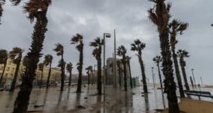
The weekend is forecast to be a time of temperature drops and weather instability across Spain.
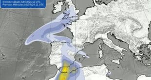
Credit : Screenshot – www.tiempo.com
Spain’s short taste of spring has come to an abrupt close. After several days of unusually high temperatures – especially along the Cantabrian coast – forecasters now warn of a sharp temperature drop this weekend, incoming Saharan dust and even the potential formation of a new DANA You can start packing your coat early next week. Think again if you haven’t packed your coat yet.
According to the forecasts of Aemet Weather platforms include eltiempo.es According to Meteored the shift will begin on Friday 27th February as an Atlantic Front moves in from the Northwest, gradually lowering temperatures and creating more unrest.
Temperatures drop as Atlantic front sweeps into
The weather will be mild in most of central and southern Spain on Friday. Areas such as Andalucía, Extremadura, Castilla-La Mancha and Madrid are expected to see highs above 20°C – pleasant, almost spring-like conditions for this time of year.
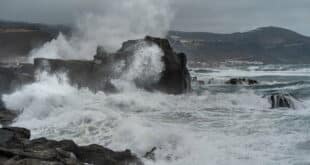
But there will be a noticeable change in the Northwest. Galicia, Asturias, Cantabria and northern Castilla y León will see increasing cloud cover and cooler air filtering in, with daytime temperatures dropping to between 12°C and 16°C.
By Saturday, the 28th of February, cooler air will be more widespread. Much of northern Spain and inland areas can expect maximum temperatures between 10°C and 15°C, particularly across the Cantabrian region, the northern plateau, Navarra, La Rioja and Aragón.
There is a chance of light rain in northern areas. This will be most noticeable in the eastern Cantabrian coastline and the Pyrenees. Later in the day, showers may develop further east, affecting Castilla-La Mancha, Aragón, Cataluña and parts of eastern Andalucía and the Valencia region.
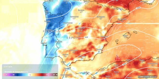
In short, the recent warmth – which saw temperature anomalies of up to 10°C or even 15°C above average in parts of the north – will feel like a distant memory.
Saharan dust clouds skies in Spain and Balearics
The calima, a well-known phenomenon, is also making a very early appearance in this year.
In the next few days, a low-pressure system over the Sahara will push tongues of Saharan Dust towards the Canary Islands, mainland Spain and the Balearic Islands. Meteored meteorologists warn that the dust will affect the southeast part of the peninsula as well as Ceuta, Melilla, and the Balearic Islands.
The result? The result? Hazy skies, reduced visibilty and that orange-grey tint in the air. Rain and dust can coincide, creating muddy showers that leave cars, terraces, and other surfaces covered in a thin layer reddish residue.
The Canary Islands will experience showers due to a DANA (isolated low-level depression). This is particularly true of the eastern islands.
Frost returns – and a possible new DANA next week
Although Sunday is the official start of spring meteorologically, it may not feel that way. Despite the fact that conditions in some parts of the country may stabilize, weak instabilities are expected to persist in the Northeast during the early hours. Later in the afternoon, scattered showers may develop over southern and eastern Spain.
Overnight temperatures will drop sharply in inland areas, with frost returning in parts of Castilla y León and other interior regions, particularly during the early hours of Saturday.
Weather models indicate that a DANA could form between Monday and Wednesday, due to a trough separating over the western part of the peninsula. This setup, while the details are uncertain, could prolong this unsettled weather pattern.
Spain’s early-spring preview is now over. After days of almost unseasonable warmth, coats, umbrellas and perhaps even ice scrapers may once again be required – a stark reminder that winter hasn’t quite finished with us yet.