Costa News Spain Breaking News | English News in Spain.

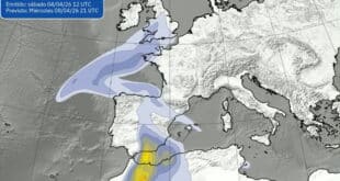
Polar jet stream will bring rain and storms to Northern Spain
Credit : X AEMET
After several sunny and calm days in Spain, the weather is about to change dramatically.
Meteorologists are warning that a polar jet stream – the powerful air current that drives storms across the northern hemisphere – will soon push a wave of Atlantic fronts towards the Iberian Peninsula, bringing heavy rain, unstable conditions, and a sharp contrast in temperatures.
Meteored (Spanish State Meteorological Agency) and AEMET (Spanish State Meteorological Agency) predict that this atmospheric river’s arrival will initially impact northwestern Spain – particularly Galicia – before spreading to other northern regions at the weekend. While the Canary Islands, the south and other regions of Spain are expected remain calmer, the north is likely to see rain or even thunderstorms.
The so-called polar jet – which flows at altitudes between 9 and 16 kilometres – acts like a high-speed highway of air that guides Atlantic storm systems. It does not mean that icy Arctic wind will blow into Spain. This dynamic band of fast moving air is what brings rain, storms and moisture straight from the sea into Europe.
Saturday will remain the same, but changes are coming.
For the time being, Saturday will be a mostly calm day with mild temperatures across most of Spain. AEMET expects a few mild showers to occur in Galicia and possibly extend into Asturias. Cantabria and the northern coasts Catalonia are also expected.
The temperatures will remain stable. However, southerly winds are expected to bring an increase in temperature along the Cantabrian coastline. Cities such as Bilbao, Badajoz, Ourense, and Seville could reach around 30°C, with nighttime lows also climbing slightly due to the increase in cloud cover.
Cloudier skies will result in warmer nights and cooler days. AEMET Explained, noting the increasing contrast in temperature as the weekend progresses.
Sunday is the real turning-point
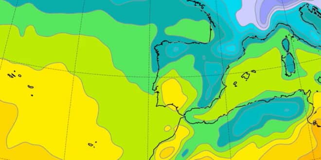
Meteorologists anticipate that the high-pressure system in the British Isles will recede by Sunday, opening the way for the deep Atlantic low-pressure systems to sweep through. The polar front will also strengthen and move directly over Spain. This will create a moist westerly flow which will bring rain and winds to the north of Spain.
The result? Spain will split into two. The storm systems will affect the northern half of Spain, while the southern half and Canary Islands remain protected by a subtropical belt, which will provide more stable temperatures and weather.
Galicia, once again, will be the hardest hit by the rain. Some western areas are expected to collect over 100 litres a square metre during the entire week. The northern regions – including Castile and León, Asturias, Cantabria, the Basque Country, Navarra, and La Rioja — are also likely to see intense, sometimes stormy rainfall.
Central and southern Spain, on the other hand, face a more uncertain future. Some weather models suggest that rain fronts may weaken in these regions before reaching them, while others predict the subtropical belt could block their advancement.
The humid westerly flow will keep temperatures mild despite the rain. The skies may be grey but it will not feel cold.
This is a welcome shift for the drought-stricken areas, particularly in the Northwest, where rain has been scarce the last few weeks. The dry spell in Mediterranean regions may persist as the easterly flows weaken, ending recent stormy rains.